The Map view displays the list of vessels on the world map. The position of each vessel is the latest AIS position available. Oceanbolt, another Veson Nautical solution, supplies the AIS data.
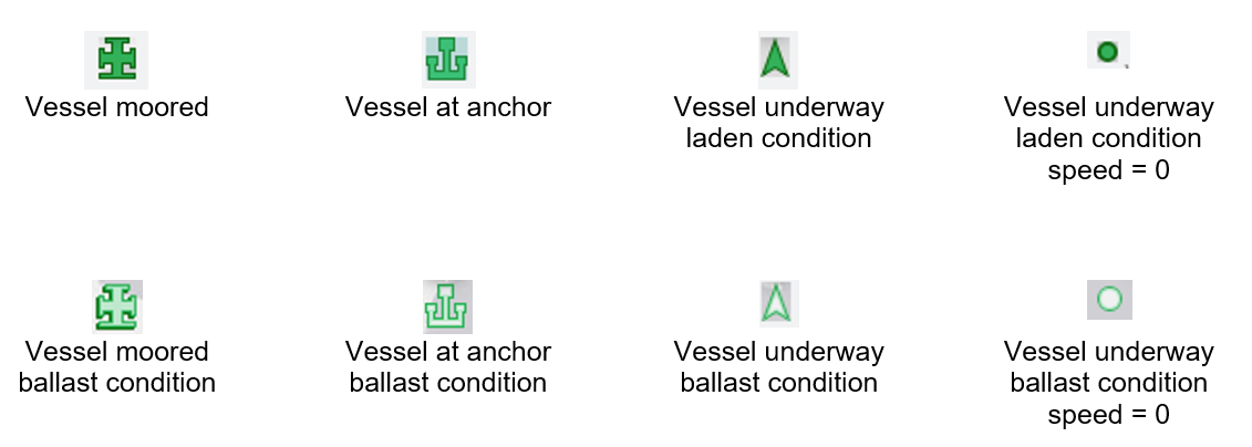
This diagram explains the meaning of different icons or symbols on the map.
Training video
See the following training video on the Map view features.
Click the link to open it in a new tab:
Map View