AIS Base Position Data
Knowing where a ship is requires a deep understanding of how to interpret raw AIS data. Our team of researchers are the best in the field.
Introduction
The VV AIS system is based on the collecting and processing of data transmitted by commercial vessels' Automatic Identification System (AIS). The main database constantly receives large amounts of data from various satellite and terrestrial AIS data providers. Every day we receive 20 million AIS message packets encoded in NMEA data format, which in turn we interpret and clean. The received AIS data is decoded, processed and stored in the main database.
VV tracks all historical vessel movements from 2009 to the present. The AIS messages contain three main types of information about the vessel including:
Static data: ship MMSI, IMO, ship name, call-sign, cargo type ID, ship length, ship width.
Dynamic data: such as a ship’s position (latitude and longitude), speed, course, heading.
Voyage-specific data: destination, ETA, draft, current navigation status
The accuracy of the AIS data is essential. We refine it using automated logic and pattern detection algorithms. Problematic positions are checked by a team of dedicated analysts. This group assesses the received satellite and terrestrial AIS data using proprietary software to cross check the three types of AIS messages, and reconcile discrepancies. This includes merging records that belong to the same vessel; removing records that do not belong to the ship, and making amendments to the route by assigning and un-assigning positions.
We have a dedicated team of ten AIS researchers who are constantly checking the data in order to identify errors and anomalies in ships behavior and to make all the necessary corrections. The AIS team investigates over 500 vessels a day.
The cleaned data creates a reliable data set that we can then interpret in our journey and stoppage logic used to assess overall fleet behavior.
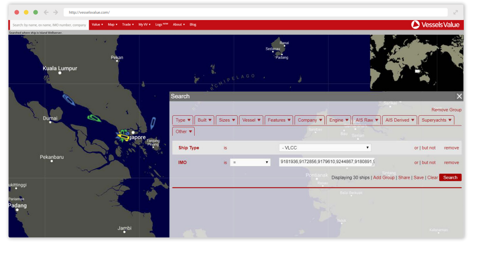
The cleaned position data is available to subscribers through the VesselsValue Mapping product.

Example of the VV mapping product
Main Quality Checks
Please find a list of the main quality checks our teams perform below:
Check for multiple ships reporting on the same MMSI and allocate the positions to the
correct vessel.Merge the many AIS signal types into a single position with latitude, longitude, heading, speed, destination, navigation status and more.
Automatically identify anomalous positions synonymous with data corruption. These outlying data points are checked daily within eight daily reports.
Using our trade journeys, we identify ships operating at an abnormally high speed.
Dead vessels that are found signaling are investigated and resolved.
There is a second hand market for the AIS transponders, and we ensure that historical data is retained for the appropriate ship, while new data is assigned to the current vessel.
Closely monitor ships that changed the MMSI, name, call sign
We identify these changes as soon as ships start signaling the new MMSI, so the new AIS data will not be missed.
Deliberate manipulation of the AIS data by the ship’s crew (i.e., changing the ship’s name, IMO, MMSI, and reporting wrong destinations and ETA).*
Vessel signals may be lost when they miss their time slot due to interference in congested areas*
Turned off transponder or as a result of jamming or spoofing of AIS data*
*The following will result in missing AIS data
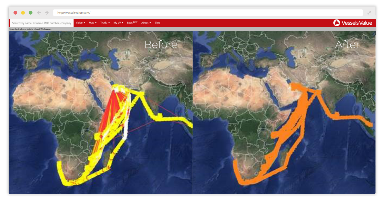
The AIS position signals (dynamic data) are identified by the MMSI number, whereas the Captain’s Reports (static data) contain the MMSI, IMO and name. When more than one vessel is signaling the same MMSI, the position reports may be assigned to the wrong ship. This causes the ships to appear in the wrong place.
The MMSI is the only common attribute that is present in both AIS reports and the biggest challenge for the AIS system is to connect the position signals with the correct vessel. Therefore, the checks we perform allow us to capture and amend the data to be of the highest quality.

Example of data before and after our cleaning process.
