This guide demonstrates how vessel messages can be submitted for a vessel/voyage.
To submit vessel messages, you must first generate vessel messages for the vessel in question.
-
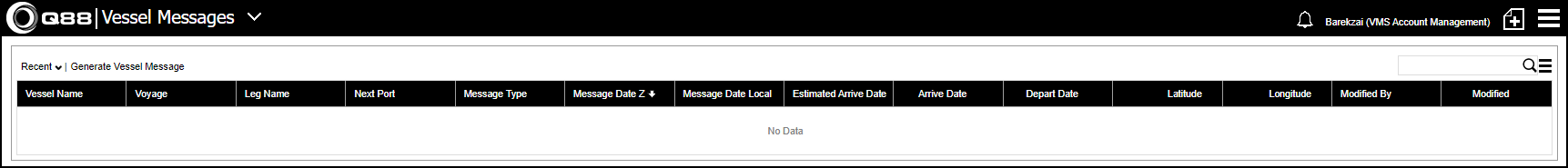
Click on the Main Menu and then select Vessel Messages.
-
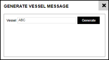
Once in the vessel messages screen, click Generate Vessel Messages and select the vessel name.
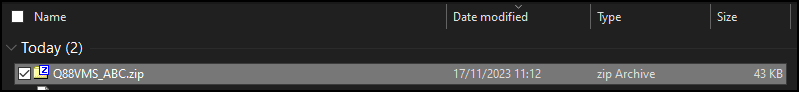
This is downloaded as a zip file with the vessel name by default. You will need to extract to access the HTML version of the file.
-
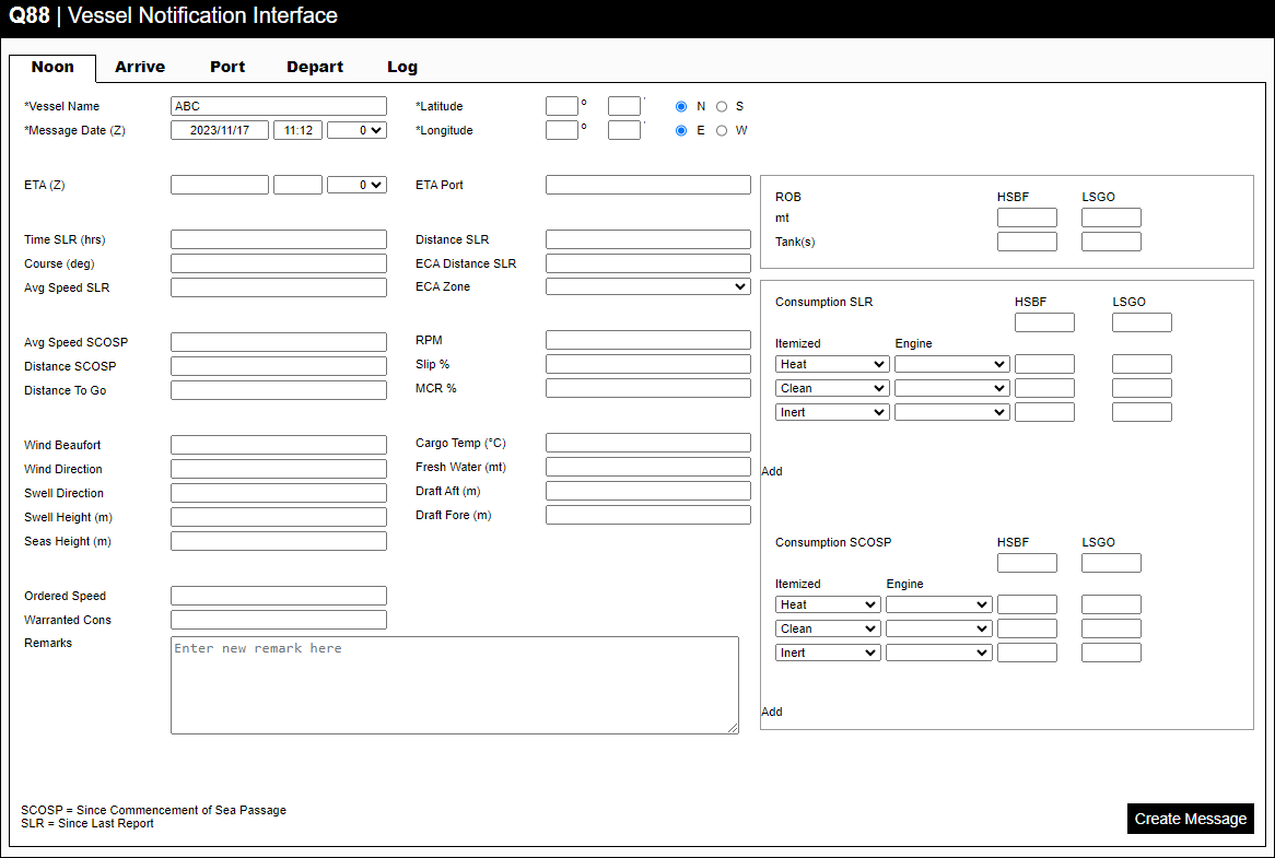
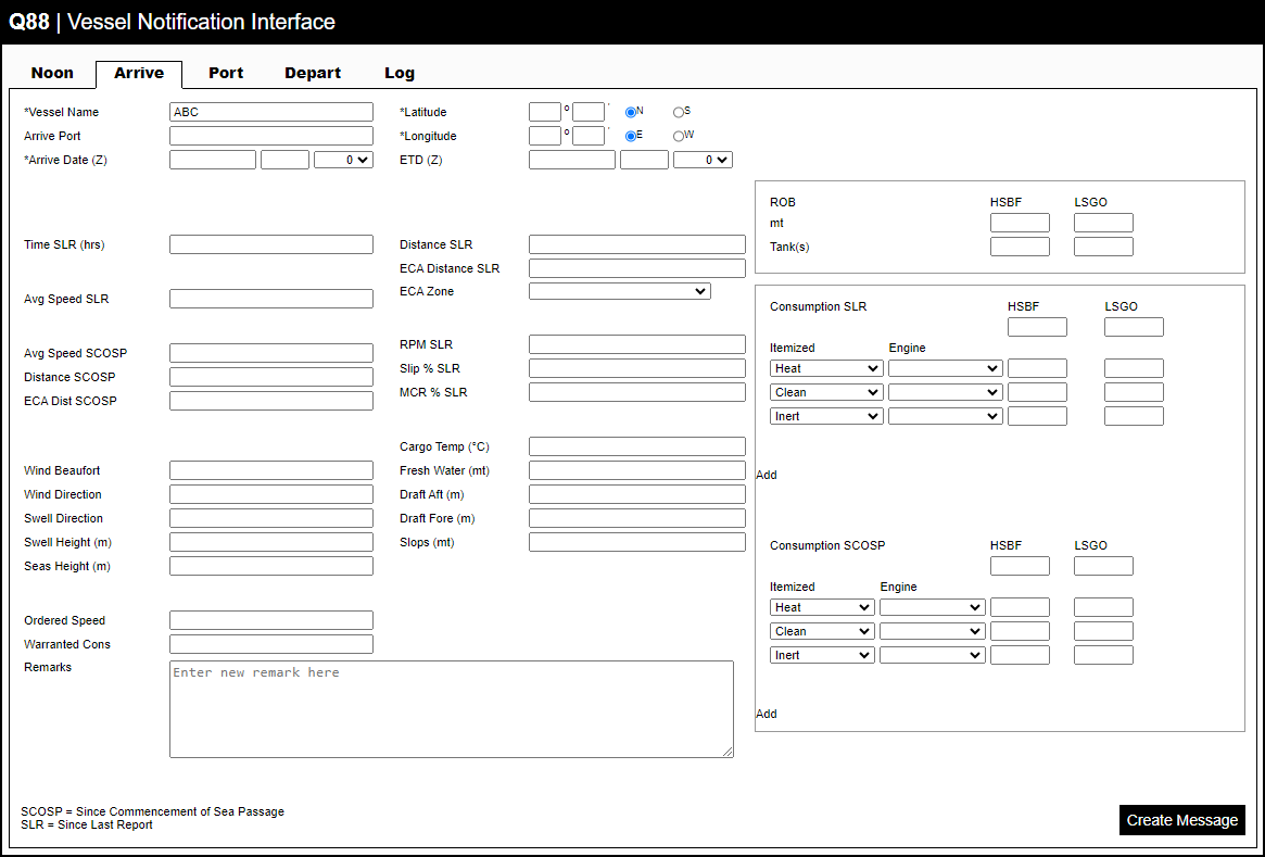
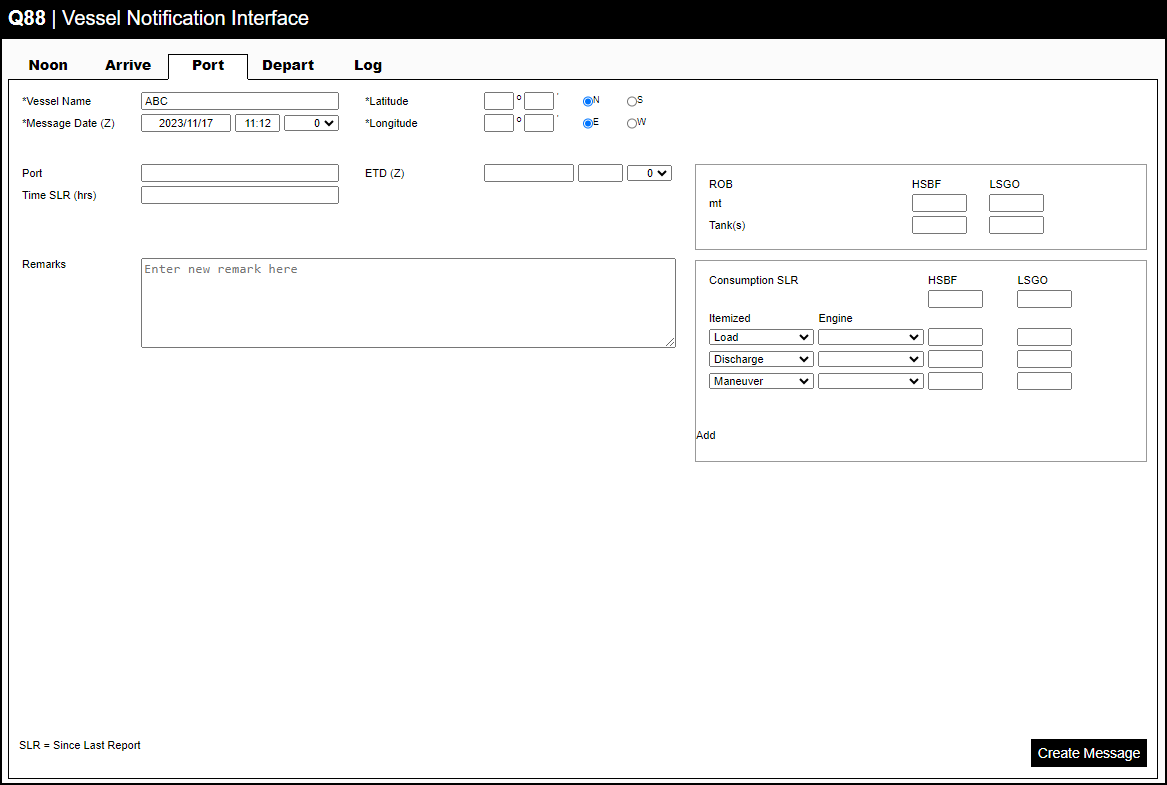
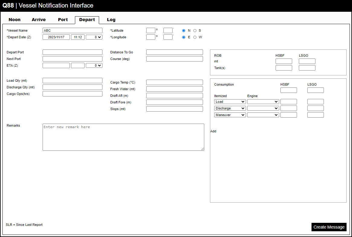
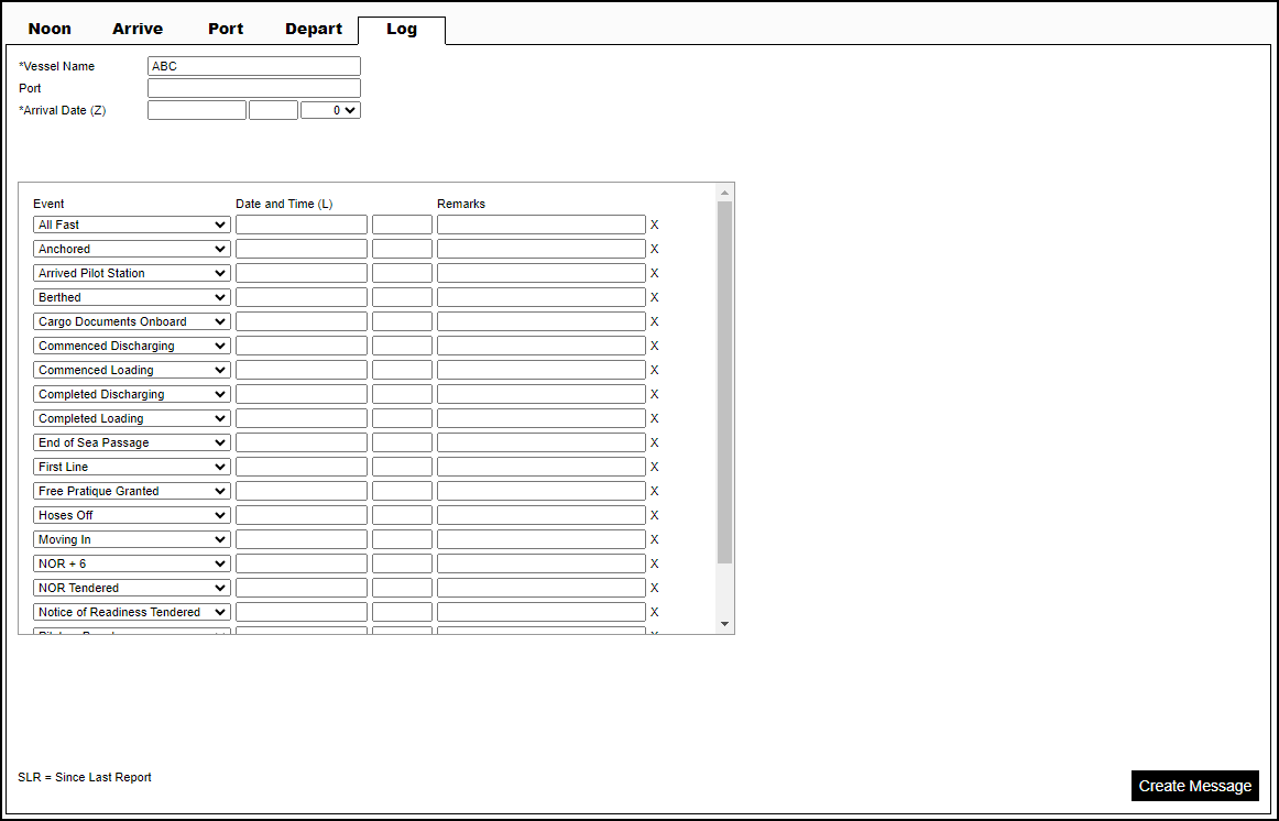
Once the Vessel Messages file has been extracted, double-click the HTML version of the file to see the prior screen. This will display all available forms shown in the following images.
-
Fill in the required form, and once completed, click Create Message.
Please note: Fields with an asterisk are required and must be filled out.
A new HTML must be submitted if a fuel grade is added/removed.
Vessel Messages & Map: The blue line is drawn linking the Vessel Messages from crew and disregarding if they go through land. VMS will not validate the coordinates coming in the messages. However, there is a very quick override that can be done. The newly saved data is what gets plotted and we also retain the original data so it is clear it was updated by a shore-side operator and not coming from the vessel. The red route is the one coming from AtoBviaC, which is a commonly used distance engine. The biggest problem with this engine is that it uses an Aframax for modeling the routes. Aframaxes are BIG ships, so they can’t go close to the shore.