Home > Data Center > How ECA Zones Are Added as Passing Ports to the Itinerary
An ECA zone is shown in the itinerary as a passing (P) port only when the vessel is moving into that ECA zone from another ECA zone. The itinerary does not show all the ECA zones that the vessel passes by, but instead shows transitions between two ECA zones. This is illustrated in the example below.
Example
Itinerary: CALDERA (COSTA RICA) to WILMINGTON DELAWARE via SAN FRANCISCO
The itinerary appears like this:
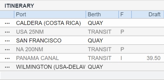
General Rule: Transitions between two ECA zones are shown, and a passing port is added when the vessel is moving into an ECA zone.
From Caldera to San Francisco, there are two ECA zones: NA 200NM and USA 25NM. Because it passes through both, the itinerary shown the transition into the second one: USA 25NM.
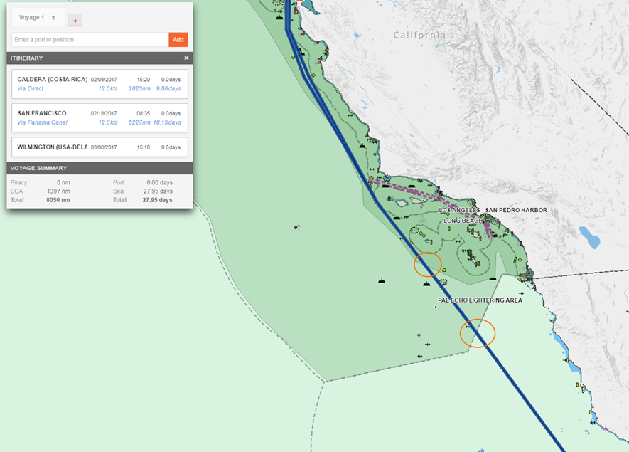
From San Francisco to Wilmington, something interesting happens: The shortest navigable distance traverses the USA 25NM, then the NA 200NM, then goes back into the USA 25NM before exiting into the NA 200NM.
Again, the itinerary shows the transitions between two ECA zones, so the first USA 25NM to NA 200NM transition shows as NA 200NM, followed by the transition into USA 25NM, and then a final transition into NA 200NM before beginning to sail to the Panama Canal.
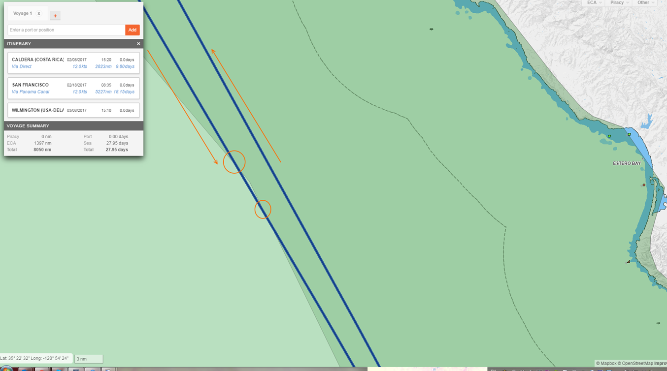
Finally, there is no ECA zone shown en route to Wilmington. This is because there is no transition between ECA zones. The vessel enters NA 200NM once, but never transitions into another ECA zone; hence there is no display of a passing point from there.