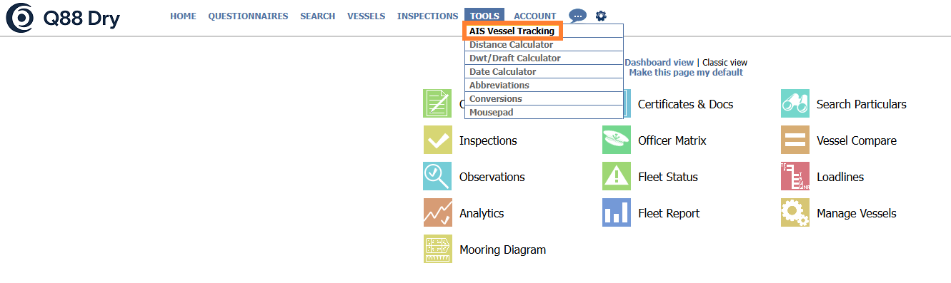
Accessing AIS Vessel Tracking
You can find the position of any registered vessel based on their AIS signal by navigating to the Tools tab → AIS Vessel Tracking.
Depending on your subscription, you can either have a coastal and/or satellite signal.
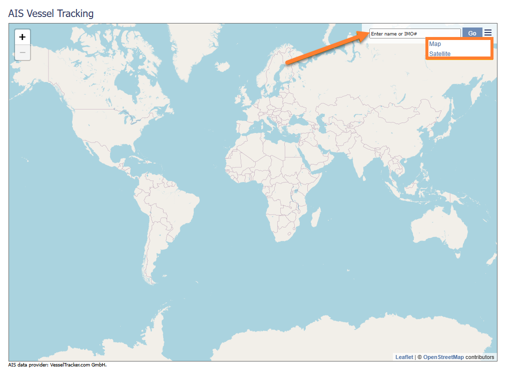
Enter the IMO number/name of the Vessel in the Search field → click on the Go button → choose between Map or Satellite view.
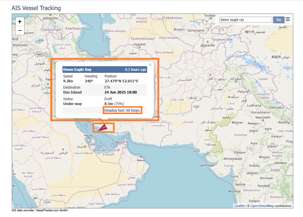
The vessel's position and basic information such as Speed, Heading, Destination, ETA, and Draft are displayed. Click the Display last 30 days to get the vessel’s routing.